


Precinct 1, Gallatin County, Montana
About
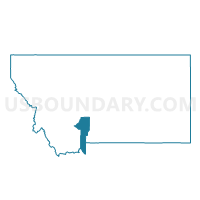
Outline

Summary
| Unique Area Identifier | 612030 |
| Name | Precinct 1 |
| County | Gallatin County |
| State | Montana |
| Area (square miles) | 338.90 |
| Land Area (square miles) | 318.51 |
| Water Area (square miles) | 20.38 |
| % of Land Area | 93.99 |
| % of Water Area | 6.01 |
| Latitude of the Internal Point | 44.73610640 |
| Longtitude of the Internal Point | -111.18668530 |
Maps


Graphs
Select a template below for downloading or customizing gragh for Precinct 1, Gallatin County, Montana


Neighbors
Neighoring Voting District (by Name) Neighboring Voting District on the Map
- 6 Island Park Voting District, Fremont County, ID
- MORAN SCHOOL Voting District, Teton County, WY
- Precinct 2, Gallatin County, MT
- WAPITI Voting District, Park County, WY
Top 10 Neighboring County Subdivision (by Population) Neighboring County Subdivision on the Map
- Madison Valley CCD, Madison County, MT (3,029)
- West Yellowstone CCD, Gallatin County, MT (1,758)
- Island Park CCD, Fremont County, ID (1,492)
- Yellowstone National Park CCD, Park County, WY (288)
- Yellowstone National Park CCD, Teton County, WY (81)
- Yellowstone National Park CCD, Gallatin County, MT (15)
- Yellowstone National Park CCD, Fremont County, ID (0)
Top 10 Neighboring Place (by Population) Neighboring Place on the Map
Top 10 Neighboring Elementary School District (by Population) Neighboring Elementary School District on the Map
Top 10 Neighboring Secondary School District (by Population) Neighboring Secondary School District on the Map
Top 10 Neighboring Unified School District (by Population) Neighboring Unified School District on the Map
- Teton County School District 1, WY (21,294)
- Fremont County Joint School District 215, ID (12,140)
- Ennis K-12 Schools, MT (3,482)
- West Yellowstone K-12 School District, MT (1,769)
- School District Not Defined, WY (288)
Top 10 Neighboring State Legislative District Lower Chamber (by Population) Neighboring State Legislative District Lower Chamber on the Map
- State House District 35, ID (43,409)
- State House District 70, MT (11,732)
- State House District 71, MT (10,573)
- State House District 23, WY (9,763)
- State House District 24, WY (8,231)
Top 10 Neighboring State Legislative District Upper Chamber (by Population) Neighboring State Legislative District Upper Chamber on the Map
- State Senate District 35, ID (43,409)
- State Senate District 35, MT (26,667)
- State Senate District 17, WY (19,969)
- State Senate District 36, MT (19,819)
- State Senate District 18, WY (18,259)
Top 10 Neighboring 111th Congressional District (by Population) Neighboring 111th Congressional District on the Map
- Congressional District (at Large), MT (989,415)
- Congressional District 2, ID (725,652)
- Congressional District (at Large), WY (563,626)
Top 10 Neighboring Census Tract (by Population) Neighboring Census Tract on the Map
- Census Tract 9653, Park County, WY (7,155)
- Census Tract 9676, Teton County, WY (4,600)
- Census Tract 1, Madison County, MT (3,108)
- Census Tract 15, Gallatin County, MT (1,773)
- Census Tract 9701, Fremont County, ID (1,492)
Top 10 Neighboring 5-Digit ZIP Code Tabulation Area (by Population) Neighboring 5-Digit ZIP Code Tabulation Area on the Map
- 59716, MT (1,798)
- 59730, MT (1,790)
- 59758, MT (1,769)
- 83429, ID (1,048)
- 82190, WY (369)
- 59720, MT (191)